Cached at:
07/02/26, 11:09 PM
# Great Salt Lake Tracker
Source: [https://growtheflowutah.org/laketracker/](https://growtheflowutah.org/laketracker/)
[https://growtheflowutah.org/](https://growtheflowutah.org/)- - [Volunteer](https://growtheflowutah.org/volunteer/) - [Legislative Action](https://growtheflowutah.org/legislative-outreach/) - [Join a Chapter](https://growtheflowutah.org/chapters/) - [Newsletter](https://growtheflowutah.org/newsletter/) - [Events](https://growtheflowutah.org/events/)
- - [Frequently Asked Questions](https://growtheflowutah.org/faq/) - [The Lake’s Impact](https://growtheflowutah.org/impacts/) - [Water Conservation](https://growtheflowutah.org/water-conservation/) - [Resources](https://growtheflowutah.org/additional-resources/) - [The Stratos Project](https://growtheflowutah.org/stratos/)
- [Newsroom](https://growtheflowutah.org/newsroom/)
- [About](https://growtheflowutah.org/about/)
- [Donate](https://growtheflowutah.org/donate/)
- - [Volunteer](https://growtheflowutah.org/volunteer/) - [Legislative Action](https://growtheflowutah.org/legislative-outreach/) - [Join a Chapter](https://growtheflowutah.org/chapters/) - [Newsletter](https://growtheflowutah.org/newsletter/) - [Events](https://growtheflowutah.org/events/)
- - [Frequently Asked Questions](https://growtheflowutah.org/faq/) - [The Lake’s Impact](https://growtheflowutah.org/impacts/) - [Water Conservation](https://growtheflowutah.org/water-conservation/) - [Resources](https://growtheflowutah.org/additional-resources/) - [The Stratos Project](https://growtheflowutah.org/stratos/)
- [Newsroom](https://growtheflowutah.org/newsroom/)
- [About](https://growtheflowutah.org/about/)
- [Donate](https://growtheflowutah.org/donate/)
**Follow the status of the largest saline lake in North America**
## Why This Tracker Matters
The Great Salt Lake is a critical indicator of Utah’s water health, economy, and environment\. Changes in lake levels affect air quality, wildlife habitat, mineral extraction, and water availability for communities across the state\. This tracker provides clear, up\-to\-date data to help Utah residents, policymakers, and advocates understand trends, risks, and the impact of water use decisions—supporting informed action to protect the lake’s future\.
## Great Salt Lake Water Level
###### Collapse
###### Critical
###### Healthy
Great Salt Lake water level data comes from USGS monitoring stations at the Saltair Boat Harbor and at Saline, UT\. These data are averaged for the previous day at midnight each day, which is why our tracker displays yesterday’s date\.

## 0
###### feet below the minimum healthy level
Great Salt Lake’s minimum healthy water level is 4,198’\.

## 0
###### of the lakebed is exposed
Compared to the lake area at its natural elevation of 4,207’\.

## 0
###### square miles of exposed lakebed
More exposed lakebed reduces habitat and increases dust storms

## 0
###### Full
Compared to the lake volume at its natural elevation of 4,207’\.
## 0
###### Salinity
12\-16% salinity is ideal for brine shrimp\.
## 0
###### South Arm Elevation
The South Arm of Great Salt Lake is measured from the USGS monitoring station at Saltair Boat Harbor\. This measurement is usually what is looked at when considering the health of the lake\. The minimum healthy level is 4198′ above sea level\.
## 0
###### North Arm Elevation
The North Arm of Great Salt Lake is measured at the USGS monitoring station at Gilbert Bay\.
Your browser does not support the video tag\.
## Links to Other Resources
###### Data Sources
[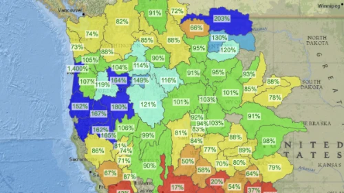#### Interactive Basin Maps Explore the snow, soil moisture, and reservoir storage in the Great Salt Lake basin\. ](https://nwcc-apps.sc.egov.usda.gov/imap/#version=169&elements=&networks=!&states=!&basins=!&hucs=&minElevation=&maxElevation=&elementSelectType=any&activeOnly=true&activeForecastPointsOnly=true&hucLabels=false&hucIdLabels=false&hucParameterLabels=true&stationLabels=&overlays=&hucOverlays=&basinOpacity=75&basinNoDataOpacity=25&basemapOpacity=100&maskOpacity=0&mode=data&openSections=dataElement,parameter,date,basin,options,elements,location,networks&controlsOpen=true&popup=&popupMulti=&popupBasin=&base=esriNgwm&displayType=basin&basinType=6&dataElement=WTEQ&depth=-8¶meter=PCTMED&frequency=DAILY&duration=I&customDuration=&dayPart=E&monthPart=E&forecastPubDay=1&forecastExceedance=50&useMixedPast=true&seqColor=1&divColor=7&scaleType=D&scaleMin=&scaleMax=&referencePeriodType=POR&referenceBegin=1991&referenceEnd=2020&minimumYears=20&hucAssociations=true&relativeDate=-1&lat=42.300&lon=-114.300&zoom=4.5)[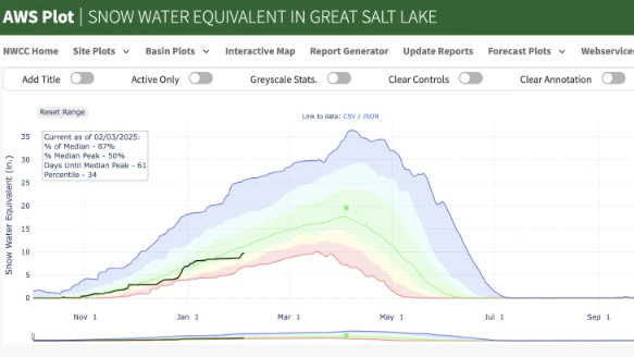#### Snowpack Snow water equivalent shows the amount of water contained in the snowpack\. This chart shows the current conditions for the whole Great Salt Lake watershed\. ](https://nwcc-apps.sc.egov.usda.gov/awdb/basin-plots/POR/WTEQ/assocHUCut3/great_salt_lake.html?state=UT)[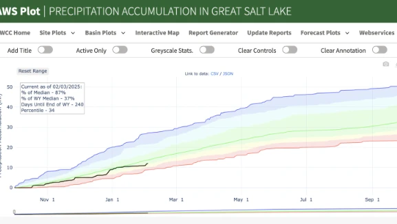#### Total Precipitation This chart shows the cumulative amount of rain and snow in the Great Salt Lake watershed for the hydrological year\. ](https://nwcc-apps.sc.egov.usda.gov/awdb/basin-plots/POR/PREC/assocHUCut3/great_salt_lake.html)
[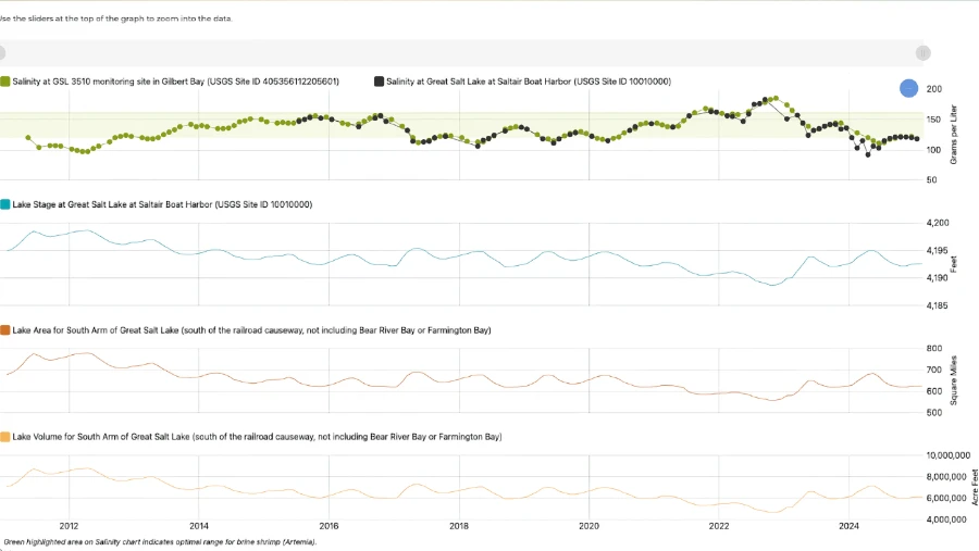#### Great Salt Lake Hydromapper The Great Salt Lake Hydromapper is a resource from the USGS that shows changes in lake level, volume, and salinity over time\. It also has information about other health indicators for the lake\. ](https://webapps.usgs.gov/gsl/)[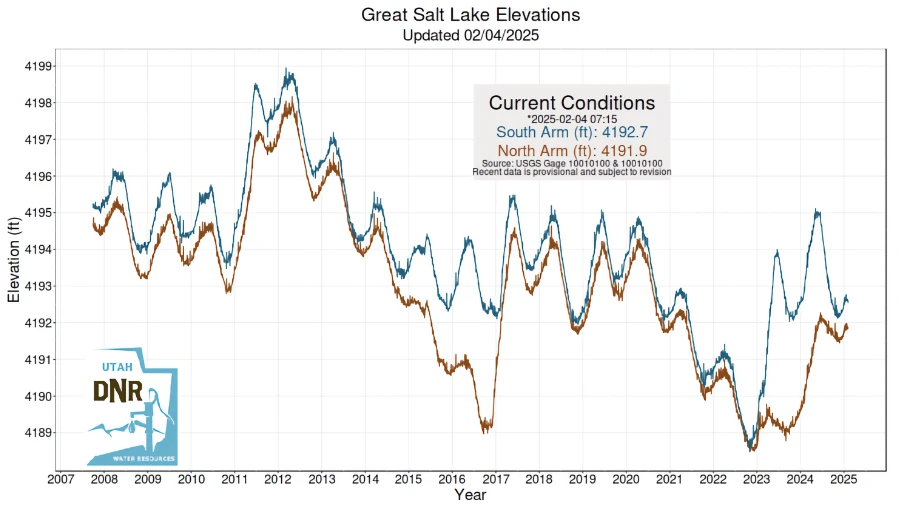#### Great Salt Lake Current Conditions The Utah Department of Natural Resources has also created a dashboard with links to various sources of Great Salt Lake data\. ](https://greatsaltlake.utah.gov/current-conditions)